
Anúncios
Measuring land accurately is essential for property transactions, construction projects, agricultural planning, and legal documentation. Modern technology has transformed this age-old practice into a precise and accessible task for everyone.


Whether you’re a homeowner verifying property boundaries, a farmer calculating field sizes, or a real estate professional assessing land value, understanding how to measure terrain correctly can save time, money, and prevent legal disputes. The methods available today range from traditional techniques using simple tools to advanced GPS-enabled smartphone applications that deliver professional-grade accuracy.
Anúncios
This comprehensive guide explores the various methods, tools, and best practices for measuring land parcels of any size. We’ll examine both conventional approaches that have stood the test of time and cutting-edge digital solutions that put surveying power directly in your pocket. 📱
Understanding the Fundamentals of Land Measurement
Before diving into specific measurement techniques, it’s important to grasp the basic principles that govern accurate land surveying. All measurement methods rely on determining distances between specific points and calculating the area enclosed by those boundaries.
Anúncios
Land can be measured in various units depending on your location and purpose. In the United States, acres and square feet dominate real estate transactions, while most other countries use hectares and square meters. Agricultural land might be measured in acres or hectares, whereas smaller residential plots typically use square feet or square meters.
The shape of your terrain significantly impacts the measurement approach. Rectangular or square plots are straightforward, requiring only length and width measurements. Irregular parcels with multiple sides demand more sophisticated calculation methods, often involving triangulation or coordinate plotting.
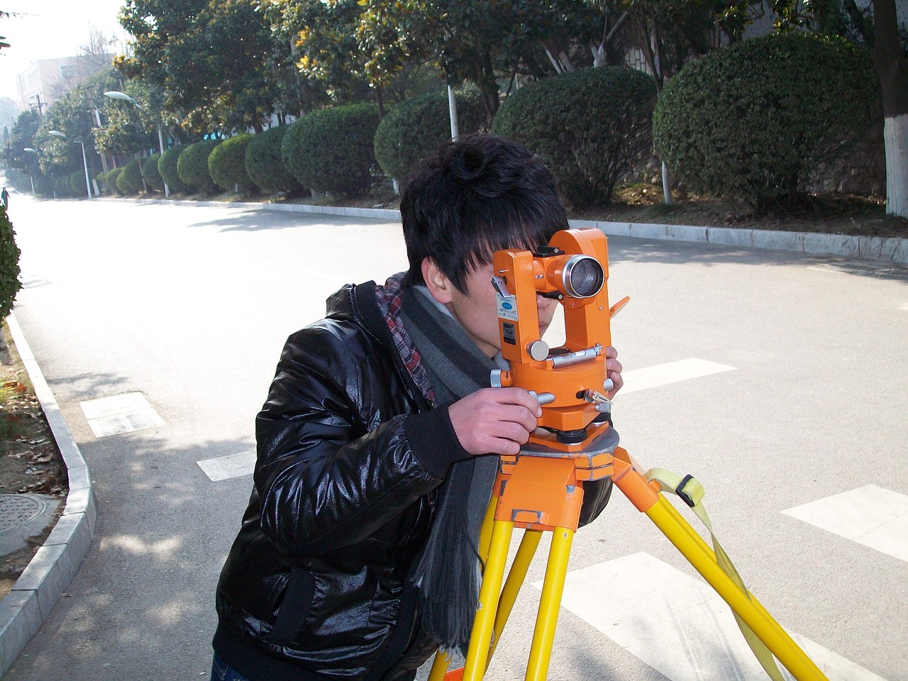
Traditional Methods That Still Work Today 📏
Despite technological advances, traditional land measurement techniques remain relevant and surprisingly accurate when executed properly. These methods require minimal equipment and can serve as backup verification for digital measurements.
The Rope and Stake Method
One of the oldest surveying techniques involves using a measured rope or chain and marking stakes. This approach works well for smaller, relatively flat parcels with clear boundaries. You’ll need a long measuring tape or rope marked at regular intervals, wooden stakes, and a notebook for recording measurements.
Start by establishing a baseline along one straight edge of the property. Drive stakes at the corners and measure the distance between them. For rectangular plots, measure the perpendicular sides and apply the simple area formula. For irregular shapes, divide the land into triangles or rectangles, measure each section separately, and sum the results.
Using a Measuring Wheel
Measuring wheels, also called surveyor’s wheels, offer a practical middle ground between fully manual and digital methods. These devices count rotations as you walk along boundaries, automatically calculating distance. They’re particularly useful for longer property lines where tape measures become cumbersome.
Quality measuring wheels can achieve accuracy within 99% when used on relatively flat, stable surfaces. They work best on open terrain without excessive vegetation or obstacles. For maximum precision, make multiple passes and average the results.
Digital Revolution: GPS and Smartphone Applications 🌍
The integration of GPS technology into consumer devices has democratized land measurement, making professional-grade surveying accessible to anyone with a smartphone. Modern apps leverage satellite positioning to create detailed property maps and calculate areas with impressive accuracy.
GPS-based measurement apps work by recording your location as you walk the perimeter of a property. The application connects these waypoints to create a polygon representing your land boundaries, then calculates the enclosed area using coordinate geometry. Most quality apps can achieve accuracy within one to three meters under optimal conditions.
Several factors influence GPS measurement accuracy. Clear sky visibility is crucial, as buildings, trees, or terrain features can obstruct satellite signals. The number of satellites your device connects with directly affects precision—more satellites mean better triangulation and improved accuracy.

Choosing the Right Measurement App
Not all land measurement applications deliver equal performance. When selecting an app, prioritize those specifically designed for area calculation rather than general mapping tools. Look for features like waypoint editing, multiple unit conversions, offline functionality, and the ability to export data.
Professional-grade apps often include advanced features such as elevation tracking, boundary adjustment tools, and integration with official cadastral maps. Some applications allow you to save multiple properties, attach photos and notes, and share measurements with stakeholders.
User interface matters significantly when you’re standing in a field trying to measure property. The best apps combine powerful functionality with intuitive controls that remain accessible even when wearing gloves or dealing with bright sunlight on your screen.
Step-by-Step Guide to Measuring Land with GPS Technology 🚶
Successfully measuring terrain with GPS-enabled devices requires proper technique and understanding of the technology’s capabilities and limitations. Following a systematic approach ensures the most accurate results possible.
Begin by checking GPS signal strength before starting your measurement. Most apps display satellite connection status—wait until you have a strong signal from multiple satellites. Avoid measuring during heavy cloud cover, in dense forests, or near tall structures that might interfere with reception.
Walk slowly and steadily along the property boundary, keeping your device at a consistent height and position. Many professionals recommend holding your phone at chest height for optimal satellite reception. Mark waypoints at every corner and direction change, being especially careful at irregular boundaries.
For irregular parcels, take your time at corners and angles. The more accurately you mark direction changes, the more precise your final calculation will be. Some apps allow you to pause measurement, which is helpful when navigating obstacles or crossing difficult terrain.
Improving Measurement Accuracy
Several strategies can enhance the precision of your GPS measurements. Whenever possible, perform measurements during clear weather with unobstructed sky views. Early morning or late afternoon often provide better conditions than midday when atmospheric interference can be higher.
Consider making multiple passes around your property boundaries. Record several measurements, then compare results. If readings vary significantly, investigate potential causes such as inconsistent walking paths or environmental factors affecting GPS reception.
Calibrate your measurements against known distances when available. If you have access to professionally surveyed boundary markers or measured fences, use these as reference points to verify your app’s accuracy under local conditions.
Professional Surveying: When to Call the Experts 🎯
While modern tools make land measurement accessible to non-professionals, certain situations demand certified surveyor expertise. Understanding when DIY methods suffice and when professional services are necessary can save significant time and prevent costly mistakes.
Legal property transactions almost always require professional surveys. Banks, title companies, and legal authorities typically won’t accept smartphone measurements for mortgage approvals, property sales, or boundary disputes. Licensed surveyors provide legally defensible documentation with accuracy guarantees that consumer tools cannot match.
Complex terrain with significant elevation changes, dense vegetation, or irregular boundaries often exceeds the capabilities of basic GPS tools. Professional surveyors use advanced equipment like total stations, laser rangefinders, and differential GPS systems that achieve centimeter-level accuracy.
Boundary disputes with neighbors absolutely require professional intervention. Attempting to resolve property line disagreements with smartphone measurements can escalate tensions and lacks legal standing. Licensed surveyors access official records, historical surveys, and legal descriptions to establish definitive boundaries.
Understanding Measurement Units and Conversions 📊
Land measurement involves various units that can confuse those unfamiliar with the terminology. Mastering these units and their conversions helps you communicate effectively with professionals and understand property documents.
| Unit | Equivalent | Common Use |
|---|---|---|
| 1 Acre | 43,560 square feet | US agricultural and residential land |
| 1 Hectare | 10,000 square meters | International standard for large parcels |
| 1 Acre | 0.4047 hectares | Conversion between systems |
| 1 Square Mile | 640 acres | Very large properties and public lands |
Most quality measurement apps automatically convert between units, allowing you to view results in your preferred system. This feature proves invaluable when working with international partners or comparing properties measured in different standards.
Common Mistakes to Avoid When Measuring Land ⚠️
Even experienced individuals make errors when measuring property. Recognizing common pitfalls helps you avoid inaccurate results that could lead to problems down the line.
Assuming property lines match visible features ranks among the most frequent errors. Fences, tree lines, and driveways don’t necessarily correspond to legal boundaries. Always reference official property documents and survey markers rather than assuming physical features represent actual borders.
Neglecting to account for easements and rights-of-way can create misleading measurements. Your property deed might show a certain area, but portions may be subject to utility easements, road access, or other encumbrances that affect usable space. Review your title documents to understand these restrictions.
Measuring in poor GPS conditions yields unreliable results. If your measurement app shows weak signal strength or significant drift while standing still, postpone your survey until conditions improve. Proceeding with poor reception wastes time and produces questionable data.
Environmental Factors That Affect Accuracy
Weather conditions directly impact measurement precision, especially for GPS-based methods. Heavy rain, snow, or thick cloud cover can degrade satellite signals. Dense foliage absorbs and reflects GPS signals, creating multipath errors that reduce accuracy in forested areas.
Topography plays a significant role in measurement challenges. Steep slopes, ravines, and hillsides make walking exact boundaries difficult and can introduce errors if not properly accounted for. Some advanced apps include slope compensation features that adjust for terrain elevation changes.
Electromagnetic interference from power lines, cell towers, and other electronic infrastructure can disrupt GPS reception. When measuring near these features, expect potential accuracy degradation and consider using alternative methods for critical boundaries.
Practical Applications for Different Property Types 🏡
The approach to land measurement varies significantly based on property type and intended use. Tailoring your method to specific applications ensures you gather the most relevant information efficiently.
Residential Properties
Homeowners typically measure land to verify property descriptions, plan landscaping projects, or estimate material quantities for fencing or paving. For these purposes, GPS apps provide sufficient accuracy while offering the convenience of immediate results and easy record-keeping.
When measuring residential lots, pay special attention to setback requirements and easements that might affect usable space. Document not just total area but also buildable portions that comply with local zoning regulations.
Agricultural Land
Farmers and ranchers use land measurements for crop planning, irrigation system design, and calculating inputs like seed and fertilizer. GPS measurement apps excel in agricultural settings where large, relatively open parcels need quick, reasonably accurate assessment.
Many agricultural measurement apps include specialized features like field subdivision tools, crop rotation planning, and integration with precision agriculture systems. These capabilities transform simple area calculation into comprehensive farm management resources.
Commercial and Development Properties
Commercial real estate and development projects demand higher accuracy standards than most consumer applications provide. While GPS apps can assist with preliminary site assessment and feasibility studies, professional surveys remain essential for permitting, construction, and legal documentation.
Use smartphone measurements during initial site visits to quickly evaluate multiple properties, then commission professional surveys for serious prospects. This approach balances cost efficiency with the precision required for major investments.
Legal Considerations and Property Documentation 📋
Understanding the legal aspects of land measurement helps you navigate property ownership responsibilities and recognize when informal measurements suffice versus situations requiring official documentation.
Property deeds contain legal descriptions that define boundaries using metes and bounds, lot and block numbers, or other survey systems. These descriptions represent the official property definition regardless of what physical measurement might suggest. Never assume your measurement supersedes recorded legal descriptions.
Adverse possession, boundary agreements, and prescriptive easements can create situations where actual property lines differ from original surveys. These complex legal concepts underscore why professional surveys matter for boundary disputes and property transactions.
Most jurisdictions maintain public records of property surveys and plat maps. Accessing these documents before conducting your own measurements provides valuable reference points and helps identify potential discrepancies worth investigating further.
Future Trends in Land Measurement Technology 🚀
Emerging technologies promise to make land measurement even more accessible and accurate. Understanding these developments helps you anticipate tools that might soon enhance your measurement capabilities.
Drone technology integrated with photogrammetry software can create detailed 3D property models and accurate area calculations. As drone regulations evolve and prices decrease, these tools will become increasingly viable for property owners seeking professional-quality results without hiring surveyors.
Augmented reality applications that overlay property boundaries onto live camera views could revolutionize how we visualize and understand land boundaries. Several companies are developing AR tools that combine GPS data with cadastral records to show property lines in real-time through your smartphone screen.
Improved satellite systems and ground-based augmentation networks continue enhancing GPS accuracy. Next-generation positioning systems promise centimeter-level precision for consumer devices, potentially eliminating the accuracy gap between professional surveying equipment and smartphone apps.
Maximizing the Value of Your Land Measurements 💡
Accurate land measurement provides more than just a number—it enables better property management, informed decision-making, and confident planning. Leveraging measurement data effectively multiplies the value of the effort invested in obtaining it.
Maintain organized records of your measurements, including dates, methods used, and environmental conditions. This documentation proves valuable when comparing measurements over time or explaining your methodology to professionals, buyers, or authorities.
Combine area measurements with other property information like soil quality, water access, topography, and improvements. This comprehensive property inventory supports everything from tax assessments to development feasibility analysis.
Share measurement data appropriately with stakeholders. Real estate agents, contractors, agricultural consultants, and other professionals work more effectively when provided accurate property dimensions. Modern measurement apps make sharing simple through export features and cloud integration.
Regular property measurement helps you detect encroachment issues early, track land use changes, and maintain awareness of your property boundaries. Annual or biennial measurements create a historical record that can prove invaluable for long-term property management and planning.