
Anúncios
Measuring land accurately is essential for property transactions, construction projects, agricultural planning, and legal documentation across the globe.


Whether you’re a homeowner verifying property boundaries, a farmer calculating field dimensions, or a real estate professional preparing documentation, understanding how to measure land correctly saves time, money, and potential legal headaches. The methods available today range from traditional surveying techniques to cutting-edge GPS technology that fits in your pocket.
Anúncios
Modern technology has revolutionized how we approach land measurement, making what once required professional surveyors accessible to anyone with a smartphone. Yet knowing when to use which method, understanding measurement units, and recognizing the importance of accuracy remain crucial skills that every property owner should develop.
📏 Why Accurate Land Measurement Matters
The significance of precise land measurement extends far beyond simple curiosity about property size. Legal property descriptions depend on accurate measurements to define boundaries, prevent disputes with neighbors, and ensure compliance with zoning regulations. A few feet of miscalculation can translate into thousands of dollars in property value or lead to costly legal battles.
Anúncios
For agricultural purposes, knowing exact field dimensions allows farmers to calculate seed requirements, fertilizer applications, and irrigation needs with precision. This optimization directly impacts profitability and sustainability. Construction projects rely on accurate site measurements to plan foundations, calculate material quantities, and ensure structures fit within designated spaces.
Tax assessments frequently depend on documented property size, meaning inaccurate measurements could result in overpayment or underpayment of property taxes. Insurance coverage also correlates with property dimensions, making accurate records essential for adequate protection.
🛠️ Traditional Methods for Measuring Land
Before digital technology transformed the field, surveyors relied on time-tested methods that remain relevant today. Understanding these traditional approaches provides context for appreciating modern innovations while recognizing situations where classical techniques still excel.
The Measuring Tape Approach
For small, regularly shaped plots, a quality measuring tape or measuring wheel offers simplicity and reliability. This method works best for rectangular or square properties where you can easily walk straight lines. Simply measure the length and width, then multiply these dimensions to calculate area. For irregular shapes, divide the property into smaller rectangles or triangles, measure each section separately, and add the results together.
The primary limitation involves accuracy over long distances and difficulty navigating obstacles like buildings, fences, or dense vegetation. Weather conditions can also affect metal tapes, which expand in heat and contract in cold.
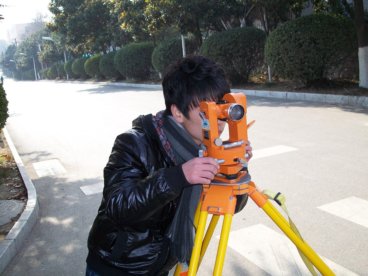
Professional Surveying Equipment
Licensed surveyors use sophisticated instruments including theodolites, total stations, and transit levels that measure angles and distances with exceptional precision. These tools create detailed plats showing exact boundaries, easements, and topographical features. While professional surveys provide the highest accuracy and legal validity, they come with significant costs ranging from several hundred to thousands of dollars depending on property complexity.
Professional surveys become necessary for legal documentation, boundary disputes, subdivision planning, and mortgage requirements. The investment proves worthwhile when legal certainty matters most.
📱 Modern GPS Technology for Land Measurement
Smartphone applications have democratized land measurement, putting powerful tools in everyone’s hands. GPS-based measurement apps use satellite positioning to calculate distances and areas as you walk property perimeters. The technology offers remarkable convenience and reasonable accuracy for many purposes.
Modern GPS apps track your movement in real-time, plotting your path on satellite imagery or topographic maps. As you walk the boundary, the application records coordinate points and automatically calculates the enclosed area. Most quality apps display measurements in multiple units including acres, hectares, square feet, and square meters.

Advantages of GPS Measurement Apps
The accessibility factor stands out immediately—no specialized training required, no expensive equipment to purchase, and measurements available whenever needed. GPS apps handle irregular shapes effortlessly, automatically calculating areas regardless of property configuration. You can save multiple measurements, export data for documentation, and share results with others instantly.
Cost-effectiveness represents another major benefit. Instead of paying hundreds for a professional survey every time you need measurements, a one-time app purchase or free application provides unlimited measurements. This proves particularly valuable for farmers managing multiple fields, real estate agents working with numerous properties, or homeowners planning gradual improvements.
Speed and convenience mean you can measure a property in minutes rather than waiting days or weeks for a professional surveyor’s availability. Immediate results enable faster decision-making for time-sensitive projects or opportunities.
Understanding GPS Accuracy Limitations
While GPS technology has improved dramatically, understanding its limitations ensures appropriate application. Consumer GPS typically achieves accuracy within 10-30 feet under ideal conditions. Factors affecting precision include satellite visibility, atmospheric conditions, tree canopy density, and nearby buildings that create signal interference.
For general planning, agricultural field management, or preliminary property assessment, GPS accuracy suffices perfectly. However, legal boundary determination, construction site preparation, or official documentation requires professional surveying with higher precision instruments.
🌍 Understanding Measurement Units
Land measurement involves various units depending on geographic location and purpose. Familiarity with different systems prevents confusion and enables accurate conversions when working across contexts.
Imperial System Measurements
In the United States and several other countries, square feet serve as the basic unit for smaller properties. Larger tracts use acres, where one acre equals 43,560 square feet. To visualize, an acre approximates the size of an American football field without the end zones. Understanding that a square measuring 208.7 feet on each side equals one acre helps with mental calculations.
Metric System Measurements
Most of the world uses metric measurements for land. Square meters form the basic unit, with larger properties measured in hectares. One hectare equals 10,000 square meters or approximately 2.47 acres. The metric system’s logical decimal progression makes calculations simpler than imperial conversions.
Quick Conversion Reference
- 1 acre = 43,560 square feet = 4,047 square meters = 0.405 hectares
- 1 hectare = 2.471 acres = 107,639 square feet = 10,000 square meters
- 1 square mile = 640 acres = 259 hectares = 2.59 square kilometers
- 1 square foot = 0.0929 square meters
- 1 square meter = 10.764 square feet
🎯 Step-by-Step Guide to Measuring Your Land
Whether using traditional methods or modern technology, following a systematic approach ensures the best results. Preparation and methodology matter as much as the tools themselves.
Preparation Phase
Begin by gathering existing documentation including property deeds, plats, tax assessments, or previous surveys. These documents provide reference points and help verify your measurements. Identify visible boundary markers such as stakes, posts, fences, or natural features mentioned in property descriptions.
Walk the property perimeter before measuring to identify obstacles, plan your route, and ensure you can access all boundaries. Note areas where vegetation might need clearing for accurate measurement or where terrain presents challenges.
Using GPS Apps Effectively
Start your measurement app and ensure GPS signal strength shows adequate satellite connection. Most quality apps display signal strength indicators—wait for optimal signal before beginning. Position yourself at a clear starting point on the property boundary, preferably at a corner or recognizable landmark.
Walk the perimeter at a steady, moderate pace, keeping your phone positioned consistently. Moving too quickly reduces accuracy as GPS coordinates update at specific intervals. The app tracks your path, creating a polygon that represents your property boundaries.
Return to your starting point to close the boundary. Most apps automatically calculate the enclosed area when you complete the circuit. Review the displayed path on the map to ensure it accurately follows the intended boundary—if sections appear obviously incorrect due to signal loss or obstacles, delete those points and re-measure that section.
Measuring Irregular Shapes
Properties rarely conform to perfect rectangles. GPS apps handle irregular boundaries automatically by plotting your actual walking path. For manual measurements using tapes, divide irregular plots into manageable geometric shapes—triangles, rectangles, trapezoids—that you can measure individually and sum together.
The triangulation method works particularly well for odd-shaped parcels. Measure a baseline along one edge, then measure distances from baseline endpoints to various boundary points, creating triangles whose areas you calculate using the formula: Area = (base × height) ÷ 2.
💡 Tips for Maximum Accuracy
Small adjustments in technique significantly improve measurement precision regardless of your chosen method. These professional tips help you achieve results approaching survey-grade accuracy even with consumer tools.
Timing Your Measurement
GPS accuracy improves during certain conditions. Clear weather with minimal atmospheric interference provides better results than storms or heavy cloud cover. Measuring during mid-morning or mid-afternoon when satellite geometry tends to be optimal can enhance precision.
Avoid measuring during dense forest leaf-out seasons if possible—winter measurements through bare branches typically receive stronger satellite signals. However, snow depth might obscure ground-level boundary markers, requiring seasonal trade-offs.
Multiple Measurements for Verification
Professional surveyors always verify measurements through redundancy—you should too. Measure your property at least twice, preferably walking the boundary in opposite directions. Comparing results reveals consistency or highlights areas needing remeasurement. If GPS measurements differ significantly between attempts, investigate factors like satellite coverage, obstacles, or walking pace variations.
Combining Methods
Using multiple measurement approaches provides cross-verification. Measure with GPS, then verify key dimensions with a long measuring tape or measuring wheel. The combination catches errors and builds confidence in your results. For important measurements affecting significant decisions, consider this hybrid approach essential.
📊 Common Measurement Scenarios
Different situations call for varying approaches and accuracy levels. Understanding context helps choose appropriate methods and tools.
Residential Property Measurement
Homeowners typically measure properties for fencing projects, landscaping planning, addition construction, or verifying property descriptions. GPS apps provide sufficient accuracy for these purposes, though building permit applications often require professional surveys. Walking the boundary with a GPS app gives you reliable square footage for planning purposes within minutes.
Agricultural Field Calculation
Farmers need field dimensions for crop planning, seed purchasing, fertilizer application rates, and irrigation system design. GPS measurement apps specifically designed for agriculture often include additional features like area subtraction for exclusion zones, distance calculation for fence runs, and yield estimation tools. The slight accuracy variance of GPS proves inconsequential when planning seed or fertilizer for large fields measured in acres or hectares.
Land Purchase Verification
When buying property, verify the advertised acreage matches reality. While your GPS measurement shouldn’t replace the professional survey typically required for closing, preliminary measurement helps identify major discrepancies before you invest heavily in the transaction. Significant differences between advertised and measured size warrant investigation before proceeding.
🚧 Common Mistakes to Avoid
Even experienced measurers make errors that compromise accuracy. Awareness of common pitfalls helps you avoid them.
Confusing Property Lines with Fences
Fences don’t always follow legal property boundaries. Previous owners might have built fences inside property lines for various reasons, or encroaching fences might extend beyond legal boundaries. Always measure actual boundary lines as described in legal documents, not fence locations.
Ignoring Topography
GPS measures horizontal distance, but sloped terrain means actual ground surface area exceeds horizontal measurement. On steep hillsides, this difference becomes substantial. For flat or gently rolling terrain, the variance remains negligible, but mountainous properties require topographic consideration or professional surveying that accounts for elevation changes.
Overlooking Easements and Setbacks
Total property area differs from usable area. Utility easements, drainage rights-of-way, required setbacks from roads or streams—these legally restricted zones reduce the space you can actually develop or use. Measuring total acreage without accounting for these restrictions leads to planning errors.
🔍 When to Hire a Professional Surveyor
Despite technology making measurement accessible, certain situations demand professional expertise. Understanding when DIY measurement suffices versus when professional surveying becomes necessary protects your interests.
Legal boundary disputes require licensed surveyors whose work carries legal weight in courts. Mortgage companies typically require professional surveys before approving property loans. Subdivision planning, easement establishment, and official property description corrections all need licensed surveyor involvement.
Construction projects where precise positioning matters—foundation placement, septic system installation, building setback compliance—benefit from professional accuracy. The cost of surveying proves minimal compared to correcting structures built in wrong locations.
Consider professional surveys an investment in legal certainty and peace of mind for significant transactions, while using GPS apps for routine planning, agricultural management, and preliminary assessments.
🌟 Maximizing the Value of Your Measurements
Accurate land measurements serve as foundations for countless decisions and projects. Documenting your measurements properly ensures future utility and reference.
Save measurements digitally with clear labels including date, location identifiers, and purpose. Export data in multiple formats—GPS coordinates, area calculations, maps with boundaries marked. This documentation proves valuable for insurance claims, property listings, project planning, and sharing with contractors or advisors.
Create a property file containing all measurement data, historical surveys, property deeds, tax assessments, and improvement records. This comprehensive reference streamlines future projects and property transactions.
Regular remeasurement helps detect encroachment, erosion, or boundary changes over time. Annual or biennial measurements of agricultural fields track productivity-related changes while monitoring residential boundaries helps identify potential disputes before they escalate.
🎓 Building Your Land Measurement Skills
Like any skill, land measurement improves with practice and experience. Start with simple, known areas to calibrate your technique and build confidence. Measure your lawn using multiple methods, then compare results to identify which approaches work best for your situation and accuracy needs.
Study your property deed and previous surveys to understand legal descriptions and professional measurement terminology. This knowledge helps you communicate effectively with surveyors and understand official documentation.
Experiment with different GPS apps to find one matching your needs and preferences. Features, interface design, and accuracy vary between applications—investing time to explore options pays dividends in efficiency and satisfaction.
The combination of traditional measurement understanding and modern GPS technology empowers property owners with knowledge and tools once exclusive to professionals. Whether planning a garden, managing farmland, or verifying property descriptions, accurate land measurement transforms abstract numbers on documents into concrete understanding of your land’s true dimensions and potential. The confidence that comes from personally verified measurements enables better decisions, smarter planning, and greater appreciation for the property you own or manage.