
Anúncios
Measuring land accurately is essential for property owners, surveyors, farmers, and real estate professionals who need precise data for planning, legal documentation, and development projects.


Whether you’re dividing property among family members, installing a fence, planning a construction project, or calculating agricultural yields, knowing how to measure land correctly can save you time, money, and legal headaches. The methods available today range from traditional techniques using simple tools to modern GPS-enabled smartphone applications that deliver professional-grade accuracy.
Anúncios
Understanding the fundamentals of land measurement empowers you to make informed decisions about your property. From small residential lots to expansive agricultural fields, each measurement scenario presents unique challenges and opportunities. Let’s explore the comprehensive world of land measurement techniques and discover which approach best suits your specific needs.
📏 Why Accurate Land Measurement Matters
Precision in land measurement isn’t just about numbers on paper—it directly impacts property values, legal boundaries, and development possibilities. A few feet of miscalculation can mean the difference between a profitable sale and a costly legal dispute.
Anúncios
Property transactions rely heavily on accurate measurements. When buying or selling land, both parties need confidence in the exact dimensions and total area. Discrepancies discovered after closing can lead to renegotiations, lawsuits, or even voided contracts.
For farmers and agricultural professionals, accurate field measurements determine planting strategies, irrigation planning, and yield predictions. Knowing precisely how many acres you’re working with helps optimize resource allocation and maximize productivity.
Construction and development projects depend on exact measurements from the planning phase through completion. Zoning compliance, building permits, and architectural designs all require verified land dimensions that meet local regulatory standards.
🛠️ Traditional Methods for Measuring Terrains
Before digital technology revolutionized surveying, professionals relied on time-tested manual techniques that remain valuable today, especially for smaller properties or quick estimations.
Measuring Tape and Walking Method
The simplest approach involves using a long measuring tape to determine distances along property lines. This method works best for rectangular or square plots with clearly defined boundaries.
To implement this technique, you’ll need a durable measuring tape (preferably 100 feet or longer), stakes to mark corners, and a helper to keep the tape taut and straight. Walk the perimeter carefully, recording each measurement and noting any irregularities in the terrain.
While straightforward, this method has limitations. Slopes, vegetation, and irregular shapes can introduce errors. It’s labor-intensive for large properties and weather-dependent, making it impractical during rain or extreme temperatures.
Surveyor’s Wheel (Measuring Wheel)
A surveyor’s wheel offers a faster alternative for measuring longer distances. This rolling device counts rotations and converts them into linear measurements, typically displaying results in feet or meters.
Professional surveyors have used these tools for decades because they handle uneven terrain better than tapes and cover ground quickly. However, accuracy depends on maintaining consistent pressure and accounting for slopes that can affect wheel rotation counts.
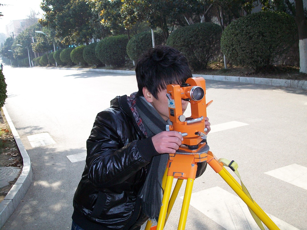
Theodolite and Total Station Equipment
Professional land surveyors employ theodolites and total stations for precise angular and distance measurements. These instruments combine optical sighting with electronic distance measurement to create detailed property maps.
While extremely accurate, these tools require specialized training and significant investment. They’re typically reserved for official surveys, boundary disputes, or large commercial projects where legal documentation demands the highest precision standards.
📱 Modern Digital Solutions for Land Measurement
Technology has democratized land measurement, placing professional-grade tools in the hands of everyday property owners through smartphone applications and GPS devices.
GPS-Based Smartphone Applications
Modern smartphones equipped with GPS capabilities can measure land areas with remarkable accuracy. These applications use satellite positioning to track your movement along property boundaries, calculating area automatically as you walk.
The convenience factor is unbeatable. Instead of carrying multiple tools, you simply walk your property with your phone, marking corners with a tap. The app handles all calculations, providing instant results in various units like acres, hectares, square feet, or square meters.
GPS accuracy has improved dramatically in recent years. While consumer-grade GPS typically offers accuracy within 15-30 feet, newer smartphones with multi-band GNSS receivers can achieve precision within 10 feet or better under optimal conditions.

Advantages of Mobile Measurement Apps
Field measurement applications offer numerous benefits beyond simple convenience. They save completed measurements for future reference, allow you to label different areas, and often include satellite imagery overlay features that provide visual context.
Cost-effectiveness stands out as a major advantage. Instead of hiring a surveyor for preliminary measurements or planning purposes, property owners can gather reliable data independently. This is particularly valuable for farmers managing multiple fields or developers evaluating potential acquisition targets.
These apps also facilitate communication. You can easily share measurement data with contractors, real estate agents, or family members through exports in various formats. Screenshots, PDF reports, and GPS coordinate files make collaboration seamless.
When to Use Digital vs. Traditional Methods
Digital tools excel for preliminary measurements, agricultural planning, and informal property assessments. They provide sufficient accuracy for most practical purposes like estimating fencing materials, planning landscaping projects, or calculating mowing areas.
Traditional professional surveys remain necessary for legal purposes, property line disputes, subdivision applications, and official recordings. Many jurisdictions require licensed surveyor certification for legal documents, regardless of how accurate your personal measurements might be.
The smart approach combines both methodologies. Use mobile apps for planning and estimation, then commission a professional survey when legal documentation or maximum precision becomes necessary.
🌍 Step-by-Step Guide to Measuring Your Land
Whether using traditional or digital methods, following a systematic approach ensures the most accurate results possible within your chosen technique’s limitations.
Preparation Phase
Begin by gathering all available property documents. Deeds, plat maps, and previous surveys provide valuable reference information and help you understand the official boundaries you’re attempting to measure.
Walk your property before measuring to identify potential obstacles. Note locations of trees, structures, water features, and steep slopes that might complicate measurements. Clear away excessive vegetation along boundary lines to improve access and visibility.
Check weather conditions if using GPS-based measurements. Heavy cloud cover, dense foliage, or proximity to tall buildings can degrade GPS signal quality. Early morning on clear days often provides optimal satellite visibility.
Executing the Measurement
Start at a clearly identifiable corner or landmark. Mark this starting point physically with a stake or flag, and note it in your measurement tool or app. This becomes your reference point for closing the perimeter.
Proceed methodically along each boundary line. When using GPS apps, walk at a steady, moderate pace along the property line. The app tracks your movement and plots points automatically, though you can manually mark corners for irregular boundaries.
For traditional tape measurements, work in straight segments between corners. Keep the tape level and taut, correcting for slopes by measuring horizontally rather than along the ground surface. Record each segment immediately to avoid confusion.
Verifying Your Results
Always complete the full perimeter, returning to your starting point. GPS apps will automatically close the polygon and calculate area, while manual measurements require adding all segments and applying geometric formulas.
Compare your results against known data when possible. If your deed states the property contains 2.5 acres and your measurement shows 4.8 acres, investigate the discrepancy before relying on your figures.
Repeat measurements for critical applications. Taking two or three separate measurements and averaging the results reduces random errors and increases confidence in your data.
🔢 Understanding Units and Conversions
Land measurement uses various units depending on location, purpose, and tradition. Familiarity with common units and conversion factors prevents costly misunderstandings.
Common Land Measurement Units
In the United States, acres dominate land measurement discussions. One acre equals 43,560 square feet or approximately 208.7 feet per side for a square plot. Residential lots are often described in square feet, while agricultural and undeveloped land typically uses acres.
The metric system employs hectares for larger properties, with one hectare equaling 10,000 square meters or approximately 2.471 acres. Many countries exclusively use metric measurements, making conversion skills essential for international property considerations.
Square meters serve as the fundamental metric unit for smaller properties and building plots. Understanding that 1 acre equals approximately 4,047 square meters helps bridge between systems when reviewing international listings or working with foreign contractors.
Quick Conversion Reference
Memorizing key conversions streamlines property discussions. One square mile contains 640 acres, making it easy to visualize large tracts. A football field (including end zones) spans roughly 1.32 acres, providing a familiar reference point.
For metric conversions, remember that 100 meters by 100 meters equals one hectare. This makes quick mental calculations easier when walking property boundaries or estimating areas from maps.
Mobile measurement apps typically display results in multiple units simultaneously, eliminating manual conversion needs. However, understanding the relationships between units helps you recognize unreasonable results that might indicate measurement errors.
⚠️ Common Measurement Mistakes to Avoid
Even experienced property owners make errors that compromise measurement accuracy. Awareness of these pitfalls helps you avoid them and achieve more reliable results.
Assuming Straight Lines
Property boundaries rarely follow perfectly straight paths. Natural features, historical survey markers, and legal easements create irregular boundaries that require careful attention to detail.
When using GPS apps, walk the actual boundary rather than cutting corners or assuming straight connections between known points. Those seemingly insignificant curves can add or subtract significant area from your total measurement.
Ignoring Elevation Changes
Sloped terrain introduces measurement complications. A 100-foot tape measure stretched along a 20-degree slope actually covers less than 100 feet of horizontal distance, which is what matters for area calculations.
GPS elevation data can help account for terrain variations, though consumer GPS altitude measurements are less accurate than horizontal positioning. For properties with significant elevation changes, consider professional surveying to ensure legal accuracy.
Poor GPS Signal Conditions
GPS accuracy degrades under tree canopies, near buildings, in valleys, or during poor weather. Taking measurements during optimal conditions dramatically improves results.
If you must measure in less-than-ideal conditions, walk slowly and allow the GPS receiver maximum time to establish accurate positioning. Some apps display current accuracy estimates, helping you judge data reliability in real-time.
Confusing Gross vs. Net Area
Total property area differs from usable area. Wetlands, easements, setback requirements, and unbuildable slopes reduce the effective usable space below the gross measurement.
When planning development or agricultural use, research local regulations that might restrict how you can utilize certain portions of your property. Your 10-acre parcel might have only 6 buildable acres after accounting for all restrictions.
🌾 Specialized Applications for Different Land Types
Different property types present unique measurement challenges and opportunities that benefit from specialized approaches.
Agricultural Fields
Farmers need accurate field measurements for crop planning, input calculations, and yield tracking. GPS measurement apps designed for agriculture often include features like planting row calculation, irrigation planning, and harvest estimation based on area.
Irregular field shapes created by natural boundaries, roads, and waterways make manual measurement impractical. GPS walking the perimeter provides accurate data quickly, allowing farmers to focus on productive work rather than tedious calculations.
Multiple field tracking becomes essential for rotation planning and record-keeping. Apps that save measurements with labels and notes help farmers maintain organized data across growing seasons.
Residential Properties
Homeowners typically need measurements for fencing projects, landscaping planning, or property tax verification. Smaller lot sizes allow for either manual or GPS measurements, though GPS apps provide faster results with comparable accuracy.
Privacy fencing estimates benefit from precise perimeter measurements that account for every turn and angle. Overestimating leads to wasted materials, while underestimating causes project delays and additional expenses.
Landscaping projects require detailed area calculations for sod, mulch, paving materials, and irrigation systems. Breaking the property into distinct zones and measuring each separately provides the specific data contractors need for accurate estimates.
Forested or Rough Terrain
Wooded properties challenge both traditional and GPS measurement methods. Dense canopy interferes with satellite signals, while undergrowth impedes walking and sight lines.
For forested land, consider measuring during leaf-off seasons when GPS signals penetrate better. Alternatively, walk logging roads or cleared boundary lines where possible, using boundary markers to guide your path.
Combining measurement methods often works best. Use GPS where signals permit, supplemented with compass bearings and distance estimates for heavily obstructed sections, then have a professional verify critical boundaries.
📊 Legal Considerations and Professional Surveys
Understanding when self-measurement suffices versus when professional surveying becomes necessary protects you from legal complications and financial losses.
When Professional Surveys Are Required
Most jurisdictions require licensed surveyor certification for property sales, subdivisions, boundary disputes, and construction permits. Self-measurements, regardless of accuracy, don’t satisfy legal requirements for official documents.
Mortgage lenders typically require current surveys before approving loans on undeveloped or rural properties. These surveys must meet specific accuracy standards and include surveyor certification to satisfy lending requirements.
Boundary disputes with neighbors necessitate professional surveys. Courts only accept measurements from licensed professionals when adjudicating property line disagreements or encroachment claims.
Using Self-Measurements Effectively
Personal measurements excel for planning purposes, preliminary estimates, and informal assessments. Use them to evaluate whether a property meets your size requirements before investing in professional surveys.
Development planning benefits from accurate preliminary data. Knowing approximately how many building lots a parcel might yield helps you decide whether to pursue acquisition before committing to expensive feasibility studies.
Agricultural and maintenance planning relies on good area estimates that don’t require legal certification. Your self-measured field sizes provide sufficient accuracy for ordering seed, fertilizer, or calculating mowing time.
🎯 Choosing the Right Tools for Your Needs
Selecting appropriate measurement tools depends on your property type, accuracy requirements, budget, and frequency of use.
For Occasional Residential Use
Homeowners measuring a single property for fencing or landscaping should start with GPS measurement apps. The minimal investment (many quality apps are free or inexpensive) and ease of use make them ideal for occasional applications.
A basic measuring wheel provides a good backup for quick distance checks or verifying app results. These tools cost $30-$100 and serve multiple purposes beyond property measurement.
For Regular Agricultural Applications
Farmers and ranchers benefit from investing in dedicated GPS measurement apps or handheld GPS units designed for agricultural use. These tools offer enhanced accuracy, field management features, and durability for regular outdoor use.
Some agricultural GPS systems integrate with farm management software, allowing seamless data transfer for yield tracking, input management, and regulatory compliance reporting.
For Professional or Legal Purposes
Real estate professionals, developers, and contractors should maintain relationships with licensed surveyors rather than attempting to substitute self-measurements for professional services.
However, preliminary site assessments using GPS apps can streamline your workflow and help you screen properties efficiently before commissioning formal surveys on promising candidates.
🚀 Maximizing Accuracy with Mobile Apps
Getting the best results from GPS measurement applications requires understanding their capabilities and limitations while following best practices.
Optimize GPS Signal Quality
Clear sky visibility produces the most accurate results. Avoid measuring during heavy cloud cover, storms, or in areas surrounded by tall structures that block satellite signals.
Allow your device time to acquire strong GPS locks before beginning measurements. Most apps display signal strength indicators—wait until signal quality reaches optimal levels before starting your walk.
Keep your phone positioned consistently, preferably holding it away from your body to minimize signal interference. Some users achieve better results carrying the phone in a chest pocket rather than hand-holding.
Walking Technique Matters
Maintain a steady, moderate walking pace along boundaries. Moving too quickly can cause the app to miss subtle boundary curves, while stopping frequently may introduce erratic GPS points.
Stay directly on the property line rather than walking parallel paths offset by several feet. Small position errors multiply when calculating total area, especially on larger properties.
For irregular boundaries, manually mark corner points by tapping the screen. This creates more accurate polygon shapes than relying solely on continuous GPS tracking around complex angles.
Verify and Validate Results
Compare your measurement against known data sources. Property deeds, tax records, or previous surveys provide reference points for validating your results.
Repeat the measurement if time permits. Taking two separate measurements and averaging the results increases reliability and helps identify anomalous data from poor GPS conditions.
Export and save your data immediately after completing measurements. Apps can crash, phones can fail, and unsaved measurements represent wasted effort that’s frustrating to repeat.
🌟 Future Trends in Land Measurement Technology
Measurement technology continues advancing rapidly, with emerging innovations promising even greater accuracy and convenience for property owners.
Drone-Based Measurement
Consumer drones equipped with GPS and cameras now offer photogrammetry capabilities that create detailed property maps and precise area calculations from aerial imagery.
These systems provide visual documentation alongside measurements, helping you understand property features and plan development projects. As drone technology becomes more affordable, it’s increasingly accessible for individual property owners.
Augmented Reality Applications
Emerging AR measurement apps overlay property boundaries and measurement data onto real-time camera views, helping you visualize boundaries while standing on the property.
This technology shows particular promise for property line identification and fence planning, allowing you to see exactly where boundaries fall relative to existing features before committing to construction.
Enhanced GPS Accuracy
New satellite systems and multi-frequency GPS receivers in smartphones are pushing consumer GPS accuracy to unprecedented levels. Some newer phones achieve precision within 3-5 feet under optimal conditions.
As this technology becomes standard in mainstream devices, the gap between professional surveying equipment and consumer tools continues narrowing for many practical applications.
Measuring land accurately no longer requires expensive equipment or professional expertise for many common applications. Modern GPS-enabled smartphones put powerful measurement capabilities directly in your hands, whether you’re a farmer managing crops, a homeowner planning improvements, or a developer evaluating properties. By understanding the strengths and limitations of different measurement approaches, you can choose the right tool for your specific needs and achieve reliable results that inform better decisions about your property. Remember that while technology makes measurement easier than ever, legal and critical applications still benefit from professional surveying services that provide certified accuracy and legal documentation.